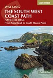
Guidebook to walking the entire South West Coast Path National Trail. The route stretches 630 miles from Minehead to Poole along the north Devon, Cornish, south Devon and Dorset coastline. Divided into 45 stages, this national trail could be completed within 4 weeks, or walked in sections. Guide includes maps and essential information.
This Cotswolds, Stratford-upon-Avon & Oxford guidebook is perfect for independent travellers planning a longer trip. It features all of the must-see sights and a wide range of off-the-beaten-track places. It also provides detailed practical information on preparing for a trip and what to do on the ground. And this Cotswolds, Stratford-upon-Avon & ......
The South West Coast Path is Britains longest National Trail, stretching some 630 miles (1014km) between Minehead in Somerset and Poole in Dorset. It takes in a National Park, 5 Areas of Outstanding Natural Beauty, National Heritage Coasts and a UNESCO World Heritage Site. This booklet of Ordnance Survey 1:25,000 Explorer maps has been designed ......
New expanded edition of the best-selling adventure guidebook. Wild swimming, secret beaches, lost ruins, caverns, ancient forests, treehouses, micro-breweries. Hundreds of photographs and maps. 1000 locations with coordinates and directions.
This booklet of Ordnance Survey 1:25,000 Explorer maps shows the northern part of the route between Minehead and St Ives, providing all the mapping you need to walk the trail in either direction. It is conveniently sized for slipping into a jacket pocket or top of a rucksack. Two separate map booklets cover the route from St Ives to Plymouth and ......
A booklet of the mapping needed to walk the northern section of the 1015km (630 mile) South West Coast Path National Trail between Minehead and St Ives. The full route is shown on 1:25,000 OS maps The map booklet can be used to walk the trail in either direction Sized to easily fit in a jacket pocket or rucksack The relevant ......
A booklet of the mapping needed to walk the western section of the 1015km (630 mile) South West Coast Path National Trail between St Ives and Plymouth. The full route is shown on 1:25,000 OS maps The map booklet can be used to walk the trail in either direction Sized to easily fit in a jacket pocket or rucksack The relevant ......
Explore the splendour of Georgian Bath with this handy, pop-up map. This genuinely pocket-sized Bath city map features a detailed street map of Bath as well as advice on the top things to see while you're there. Ideal to pop in a pocket or bag for quick reference while discovering this magical city.
The best-selling Wild Swimming Walks series returns with adventures along England's most impressive coast, moors and downs. Ascend to the secret pools and descend through a valley of secret waterfalls * Walk through woodland gorges carved by cascades * Follow bucolic river valleys dipping as you walk.